|
Picturesque
|
|
[HOME] [WESTERN AMERICANA GALLERY] [ROUTE 66 HOME] [ROUTE 66 WEST] [ROUTE 66 EAST]
|
Picturesque
|
|
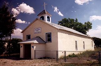
| Upon entering San Fidel I was immediately impressed. The quaint mission styled St. Joseph Catholic Church caught my attention right off the bat. I was suddenly struck by the change in the country I had been travelling through. Eastern New Mexico was most definitely ranching country. It was John Wayne country in my mind, heavily influenced by the cowboy mystique. Since passing Albuquerque I had entered into the heart of the Spanish and Indian Territory, rich with the history of ancient cultures. Everything here was old and seasoned with the passing of time. Countless generations of human drama had lent a special aura to the country and San Fidel seemed to be the epitome of this. In my mind it was the quintessential New Mexican village. | ||
|
|
|
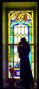
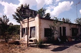
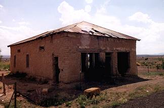
| Jack Rittenhouse gives the population of San Fidel at 128 in 1946. I'm not sure if its much more than that today. Certainly the fading of old Route 66 didn't help. In Rittenhouse's time there were many Indians sitting along the roadway selling pottery. In his guidebook he recounts an amusing tale he heard about one clever Indian girl, tired of all the "sharp-bargaining, callous tourists." She retaliated "by collecting some cockle-burrs which she sold to a tourist as very rare 'porcupine eggs.' The tourist bought them!" Today I didn't see any Indian vendors but I did see a couple old closed down stores and cafe, and an abandoned adobe building along the road. San Fidel is still alive though and it still has an operational post office that was established in 1919. |
|
|
|
|
|
McCarty aka Santa Maria, New Mexico |
||
|
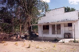
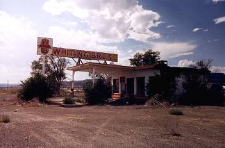
One more closed Whiting Brothers Gas Station stands forgotten outside of McCarty, New Mexico |
|
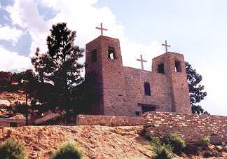
| McCarty was named after a contractor who lived here during the construction of the Santa Fe Railroad in the 1880s. It is the gateway to Acoma Pueblo also known as the "Sky City." McCarty is also known as Santa Maria, this is the name Jack Rittenhouse used in his 1946 guidebook. He describes Santa Maria as a small cluster of adobe homes and a mission church clinging to the rocky side of the mesa. No tourist facilities except for a gas station at the highway. Today not much has changed. The old mission church still stands and is a classic example of the Spanish Colonial style of architecture. |
|
|
Photographs Taken September 2002
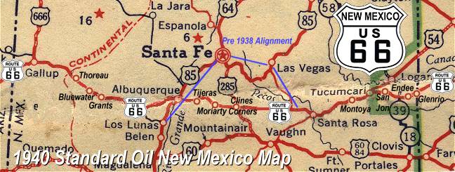
Click on an area or city of Route 66 on the map below to take a cyber tour of that section of the Mother Road |
|
|
NAVIGATION NOTE: Buckle up and hold on to your mouse! These pages are arranged like the map above, from the western state border to the eastern state border. I have set up this site as if you were traveling from EAST to WEST, much like the Joad family in The Grapes of Wrath. You can click on the Route 66 shields to "travel" the Mother Road in either direction though. Or you can select any shield below to take you to that specific state. |
|
To Grants |
To Laguna Pueblo Area |

© Copyright 2003 GRandall Web Design Service