|
Over on the
|
|
[HOME] [WESTERN AMERICANA GALLERY] [ROUTE 66 HOME] [ROUTE 66 WEST] [ROUTE 66 EAST]
|
Over on the
|
|
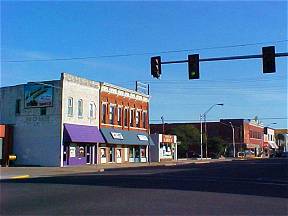
El Reno, Oklahoma |
||||
| After leaving Oklahoma City and going west on Route 66 the land slowly starts to change. The green and well watered eastern part of the state gives way to the semi-arid prairies and rolling hills of western Oklahoma. The land, though still abundantly rich with foliage, is drying out. This is a prelude for things to come as Route 66 enters the fabled west. | ||||
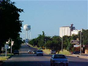 |
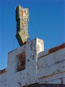
El Reno, Oklahoma is a prosperous old Route 66 town with a great western flavor. Many photo opportunities exist for the observant shutter bug. |
|
||
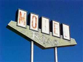 |
El Reno began its life as Fort Reno in 1874 during the Cheyenne Uprising to protect the Darlington Indian Agency. It was named for Major General Jesse L. Reno who was killed in the Civil War. In 1889 the Rock Island Railroad built a line up to the south bank of the Canadian River rather than the north bank where the outpost of Reno City was located near the old fort. The town decided to move, buildings and all, to meet the railroad on the south bank and the town of El Reno was officially established. In 1901 El Reno was the site of the lottery drawing for the last free territory land for settlement. Today pockets of old Route 66 can still be found in this historic city. Old cafes, motor courts and gas stations attest to the time that El Reno's main street was also the main street of a nation. | |||
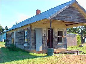 |
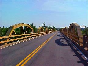
Bridgeport Hill and the Pony BridgeThis old service station stands as silent witness to the time that Route 66 ran through the area from El Reno to Hydro and Weatherford. This was along the El Reno cutoff, a newer section of Route 66 that bypassed the Route 66 towns of Calumet, Geary, and Bridgeport in 1933. A new bridge was built below Bridgeport Hill at the Canadian River. The Canadian River bridge or Pony Bridge as it was called replaced a toll suspension bridge between Geary and Bridgeport effectively sealing the fate of those two towns. Geary held on but today Bridgeport is a true ghost town. |
|||
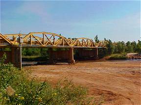 |
The Pony Bridge at the Canadian River is 3944.33 feet long and contains 38 pony trusses. It was completed July 1, 1933. |
|
||
| An interesting side note about this historic steel tress bridge is that it is featured in the 1939 classic film "The Grapes of Wrath" staring Henry Fonda. The scene where grandpa dies and is buried was shot near the west end of this bridge. Then the bridge was only 6 years old! If you watch the movie carefully you can see the Canadian River plain and the Pony Bridge in the distance. | ||||
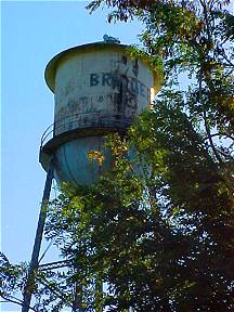 |
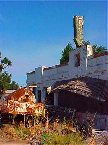
Bridgeport, Oklahoma is but a shadow of its former self. It was bypassed in 1933 when Route 66 had its alignment changed. Many residents of the town picked up and moved - including their businesses - to the new alignment of Route 66. Before the Pony Bridge was build in 1933 Bridgeport was the western terminus of a safe Canadian River crossing. Here a privately owned suspension bridge was built to allow the crossing of the Canadian River. The owner and builder not only recouped the cost of constructing the bridge but made a handsome profit to boot. Known as the Key Bridge, it was constructed in 1921 by Oklahoma City businessman, George Key. The toll for crossing the Canadian River on the Key Bridge was $1.00 for autos and $1.50 for trucks. Back in the 1920s that was pretty steep indeed. Route 66 travelers were outraged. In 1930 the bridge was bought by the state of Oklahoma and the fee was dropped. The state already had plans for another bridge however, and after the Pony Bridge opened the Key Bridge fell into disuse and was finally sold for scrap. | |||
|
|
|||
Forgotten
Route 66 businesses at Bridgeport. This cafe and motor court |
||||
Photographs Taken May, June 2003
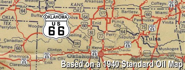
Click on an area or city of Route 66 on the map below to take a cyber tour of that section of the Mother Road |
|
|
NAVIGATION NOTE: Buckle up and hold on to your mouse! These pages are arranged like the map above, from the western state border to the eastern state border. I have set up this site as if you were traveling from EAST to WEST, much like the Joad family in The Grapes of Wrath. You can click on the Route 66 shields to "travel" the Mother Road in either direction though. Or you can select any shield below to take you to that specific state. |
|
To Hydro &
|
To Oklahoma
|

© Copyright 2003 GRandall Web Design Service