 |
Route 66 in the
|
|
[HOME] [WESTERN AMERICANA GALLERY] [ROUTE 66 HOME] [ROUTE 66 WEST] [ROUTE 66 EAST]
|
Route 66 in the
|
|
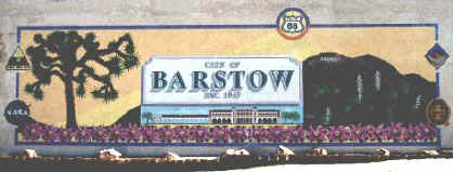
All Trails Lead to Barstow |
|
|
|
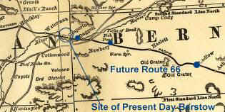
| Barstow, where the old trails meet. The Old Mormon Trail, now I-15, and Route 66, now replaced by I-40 come together here in the high desert. This old railroad map from the 1880's shows the route that will become Route 66 half a century later. The area of present day Barstow is shown as Grapevine and Waterman; Barstow wasn't even named yet! | |
| In 1858 Army dragoons camped here and called the area Camp Sugar Loaf. The area became known as Grapevine when a trading post was established in 1864. The name was changed to Waterman Junction in 1881. Then in 1886 a depot for the Atlantic and Pacific Railroad (Santa Fe RR) was built here and the town of Barstow was officially founded - complete with post office. |
|
|
|
|
|
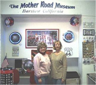
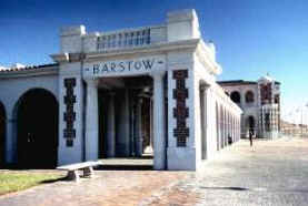
| Barstow, named after William Barstow Strong, was the president of the Santa Fe Railroad at that time.The beautiful Railroad Depot was built in 1910 and also served as a Harvey House. Today it has been restored by the city of Barstow and is the site of the Route 66 Mother Road Museum. Next door to the museum the City of Barstow has just opened its new Railroad Museum. You haven't seen Barstow if you haven't seen these great museums! | ||
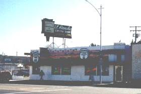
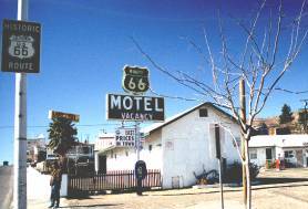
| Barstow is another Route 66 town that takes pride in its heritage. There is still much of Old Route 66 to see in Barstow. The famous El Rancho Motel, built with railroad ties from the defunct Tonopah & Tidewater RR, and El Rancho Cafe are Mother Road landmarks. And who could forget the Route 66 Motel on Main Street (Route 66). As you drive Route 66 out of Barstow you will come to Lenwood, another Route 66 town on the National Old Trails Highway. |
|
|
|
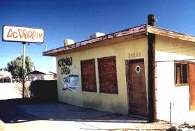
Look for signs of the old road in Barstow and Lenwood such as the Route 66 Motel or Do Drop Inn at an old motel court. |
|
Photographs taken January 2001
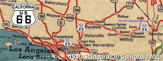
Click on an area or city of Route 66 on the map below to take a cyber tour of that section of the Mother Road |
|
|
NAVIGATION NOTE: Buckle up and hold on to your mouse! These pages are arranged like the map above, Pacific Ocean being West Route 66 and the Colorado River East Route 66. I have set up this site as if you were traveling from EAST to WEST, much like the Joad family in The Grapes of Wrath. You can click on the Route 66 shields to "travel" the Mother Road in either direction though. Clicking West Route 66 or East Route 66 will take you to the next town or area on the map in that direction. Or you can select any shield below to take you to that specific state. |
|
To the National Old Trails Highway |
To Daggett and Newberry Springs |

© Copyright 2003 GRandall Web Design Service
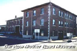 The Mother Road Museum