 |
National Old
|
|
[HOME] [WESTERN AMERICANA GALLERY] [ROUTE 66 HOME] [ROUTE 66 WEST] [ROUTE 66 EAST]
|
National Old
|
|
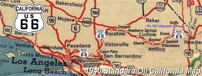
Barstow to Victorville on the National Old Trails Highway~ Old Route 66 |
|
|
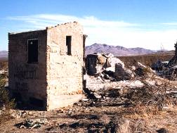
Helendale, CaliforniaThe old highway leaves Barstow and Interstate 40 to follow the Mojave River through the old Route 66 towns of Lenwood, Hodge, Helendale, and Oro Grande to rejoin the Interstate at Victorville. Along the way ghostly shadows of the Mother Road can still be seen, such as the ruins of an old store between Hodge and Helendale. A few more years and even these ruins will be a memory: nothing left but tin cans and broken glass in the desert. |
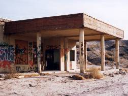
Tagger's Art at the "No
Service" Service Station |
 Burden's
Store and Post Office Burden's
Store and Post Office For many years this was the center of activity in Helendale. At one time this must have been a welcome stop for travelers on Route 66 getting ready for the treacherous Cajon Pass and LA beyond. |
|
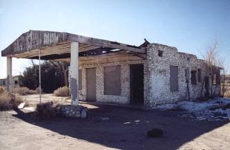
Originally built in 1943 and now in ruins, this old stone gas station and auto court along the highway between Helendale and Oro Grande attest to busier days once. |
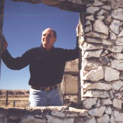 |
 Reflecting
on these forgotten memories along Route 66, I can't help but wonder about the
travelers who stayed at Potapov's long ago. Reflecting
on these forgotten memories along Route 66, I can't help but wonder about the
travelers who stayed at Potapov's long ago. |
Photographs taken February 2000 and January 2001
Click on an area or city of Route 66 on the map below to take a cyber tour of that section of the Mother Road |
|
|
NAVIGATION NOTE: Buckle up and hold on to your mouse! These pages are arranged like the map above, Pacific Ocean being West Route 66 and the Colorado River East Route 66. I have set up this site as if you were traveling from EAST to WEST, much like the Joad family in The Grapes of Wrath. You can click on the Route 66 shields to "travel" the Mother Road in either direction though. Clicking West Route 66 or East Route 66 will take you to the next town or area on the map in that direction. Or you can select any shield below to take you to that specific state. |
|
To Victorville |
To Barstow |

© Copyright 2003 GRandall Web Design Service
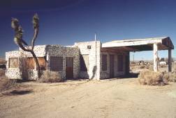
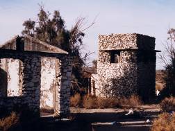 Potapov's Service Station and Auto Court