|
Cajon Pass
|
|
[HOME] [WESTERN AMERICANA GALLERY] [ROUTE 66 HOME] [ROUTE 66 WEST] [ROUTE 66 EAST]
|
Cajon Pass
|
|
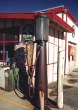
The Summit Inn at the Top of Cajon Pass |
||
|
|
|
|
||
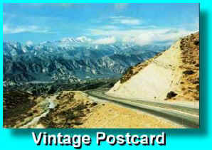 |
Cajon Pass......the famous gateway to San Bernardino and Southern California has long been an important natural route. Desert Indians had come this way for centuries, followed later by Mountain Men and early Spanish and Anglo explorers. In the early 1800's it was the southern end of the Old Spanish Trail which led to Santa Fe, New Mexico. Pegleg Smith used this trail for massive horse stealing raids in the 1840's. It is said that the infamous mountain man had a profitable business of stealing horses in California then selling them in Santa Fe. |
|
|
Santa Fe Tracks and an Old Concrete Bridge |
|
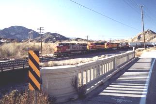 |
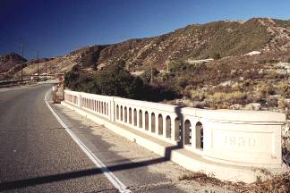 Great old 1930's Bridge next to the RR tracks on Route 66 near the
Blue Cut area. Great old 1930's Bridge next to the RR tracks on Route 66 near the
Blue Cut area. |
1930's Era Federal Camp |
|
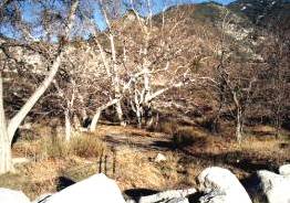 |
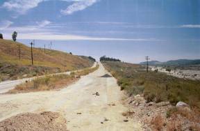
As you drive the old section of Route 66 off the Cleghorn exit (going west) look for the Swarthout Canyon Road on your right. Just around the corner behind a row of boulders is the site of an old Federal camp built in the 1930's to provide a safe haven for the Dustbowl emigrants or "Oakies," who were facing much bitter harassment from the locals. I couldn't help but think of the Federal camp mentioned in John Steinbeck's Grapes of Wrath when I was here. |
| The Blue Cut Rest Area |
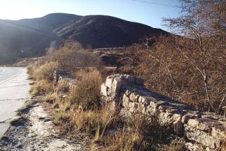 Just a little farther down the road past the Swarthout
Canyon Road there is a field stone wall on your right separating the road from Cajon
Creek. This is the site of the Blue Cut Rest Area, a once popular stop on Route 66, there
is a historical marker located here. I found the Blue Cut area of Route 66 to be one of
the most scenic sections of the Mother Road. Rest for awhile and watch the Santa Fe trains
roll by. The photo opportunities are great because the railroad tracks are so close. Just a little farther down the road past the Swarthout
Canyon Road there is a field stone wall on your right separating the road from Cajon
Creek. This is the site of the Blue Cut Rest Area, a once popular stop on Route 66, there
is a historical marker located here. I found the Blue Cut area of Route 66 to be one of
the most scenic sections of the Mother Road. Rest for awhile and watch the Santa Fe trains
roll by. The photo opportunities are great because the railroad tracks are so close.NOTE: The severe drought of summer 2002 spured wild fires across the west. Cajon Pass fell victim to one of these. We can only hope that in a few years it will once again be the beautiful place it once was. |
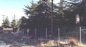
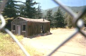
Ghosts of Old Route 66 in the Cajon Pass Area |
|
|
Another mile or so down Route 66 are some more ghosts of the old road. A lonely "EAT" sign pokes out from the thick growth. Once long ago it held the promise of food for the hungry traveler. Now there's no restaurant to been seen anywhere. Nearby an abandoned cabin speaks of a time when this stretch of Route 66 saw the passing of a nation on the move. The empty windows are like vacant eyes now, lost in remembrance of a bygone era. |
 |
Unfortunately this stretch of Route 66 comes to an end and it is time to rejoin the Interstate at Kenwood Ave. The old road still continues on over the rolling hills, but it is closed to traffic now. |
Photographs taken January & May 2001
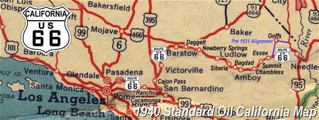
Click on an area or city of Route 66 on the map below to take a cyber tour of that section of the Mother Road |
|
|
NAVIGATION NOTE: Buckle up and hold on to your mouse! These pages are arranged like the map above, Pacific Ocean being West Route 66 and the Colorado River East Route 66. I have set up this site as if you were traveling from EAST to WEST, much like the Joad family in The Grapes of Wrath. You can click on the Route 66 shields to "travel" the Mother Road in either direction though. Clicking West Route 66 or East Route 66 will take you to the next town or area on the map in that direction. Or you can select any shield below to take you to that specific state. |
|
To San Bernardino and Foothill Blvd. |
To Victorville |

© Copyright 2003 GRandall Web Design Service
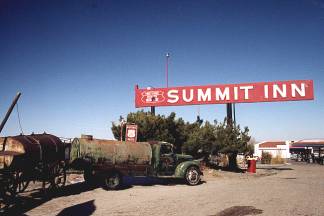
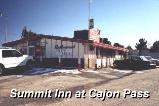
 Historic
Summit Inn
Historic
Summit Inn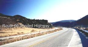 In 1861 a 12-mile toll
road through the pass was built. The road linked San Bernardino and the coastal cities to
the booming mining communities of the high desert. Cajon Pass was a natural route for the
railroad when it came in 1885. In the late 1920's the old trails over Cajon Pass became
Route 66. Portions of the old road can still be seen by taking the Cleghorn Exit off I-15.
Route 66 in this area has the distinction of being one of the first divided highways in
the United States.
In 1861 a 12-mile toll
road through the pass was built. The road linked San Bernardino and the coastal cities to
the booming mining communities of the high desert. Cajon Pass was a natural route for the
railroad when it came in 1885. In the late 1920's the old trails over Cajon Pass became
Route 66. Portions of the old road can still be seen by taking the Cleghorn Exit off I-15.
Route 66 in this area has the distinction of being one of the first divided highways in
the United States.