|
Arizona
|
|
|
Arizona
|
|
Go to Route 66 State: |
|
Welcome to Route 66 in Arizona! |
||
 |
Route 66 in Arizona is as colorful a stretch of the old Mother Road as can be found anywhere. It is a land of volcanoes, meteor craters, petrified forests and cool pine forests. Route 66 was the gateway to the Grand Canyon State and adventure. The history of the Native Americans, early pioneers, railroads, cattle drives, outlaws, and adventurers is forever entwined with the history of Arizona's Route 66. People seeking fame and fortune traveled the old trails and rails over the route that would someday become Route 66. A route that was conceived and blazed with one of the most outrageous expeditions in American history I might add! | |
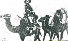
| What do Camels have to do with Route 66 you might ask? Actually a lot if you go back far enough. As a result of the gold rush of 1849, interest in transportation routes into California became more intense and widespread. In the 1850s, Congress commissioned surveys for a proposed transcontinental railroad. In 1853 four railroad surveys were authorized; one of the proposed routes was the 35th parallel running from Fort Smith Arkansas to Los Angeles. Lieutenant Amiel W. Whipple led the first expedition in 1853 across the route that would someday become Route 66. Perhaps one of the most interesting expeditions over the 35th parallel was in 1857 and used camels! |
|
|
| In 1857, Congress commissioned LT. Ned Beale to survey and identify a wagon road from Fort Defiance in New Mexico to the Colorado River. His route would become known as the Beale Wagon Road across Arizona. Perhaps what makes Beale’s expedition so noteworthy in western annals is that he used camels instead of horses! Lieutenant "Ned" Beale was in charge of a most unusual experiment. Camels were well suited to the arid southwest and the camel experiment was a resounding success. Camels very possibly could have become a fixture in the old west, and may have replaced the horse in importance, if the Civil War hadn't broken out and the camel experiment was dropped. | ||
|
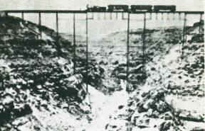
The Beale Survey trail would become the Beale Wagon Road, a route that would be followed almost 70 years later by Route 66. The Atlantic and Pacific Railroad (now Santa Fe RR) laid its tracks along Beale's Camel Road in the 1880's. These are the same tracks that ran parallel to Route 66 throughout the Southwest, and still run parallel to Interstate 40 today. Beale’s wagon road remained an unimproved trail across the largely uninhabited desert Southwest throughout the nineteenth century. Not until the arrival of automobiles in the first decade of the twentieth century did the American public begin to clamor for the route’s improvement. | |
| Cruising down Interstate 40 today it is hard to imagine all the people who have gone this way over the years. Even Canyon Diablo, so named because it was a major obstacle to the early travelers, is hardly noticeable at the interstate speed of 75 miles per hour when you cross it at Two Guns. | ||
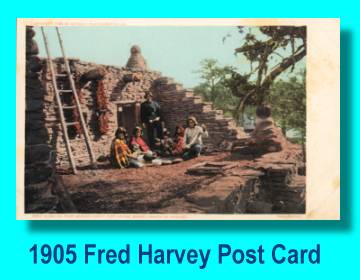
| Arizona was a tourist's paradise from day one. The Grand Canyon, and Painted Desert, not to mention the romance of Indian Country and the Old West attracted visitors from all over the world. The Santa Fe Railroad launched an extensive campaign at the turn of the century to lure tourists out to the wild west and mingle with the local cowboys and Indians. With the advent of Route 66, tourism became a major economic resource along the old road. For many easterners, Route 66 in Arizona and New Mexico afforded them their first encounter with Native Americans. Arizona was Indian Country! If you like Trading Posts, Arizona was the place to be. |
|
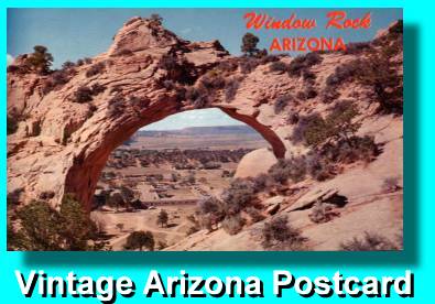
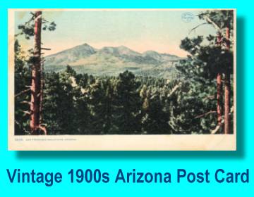
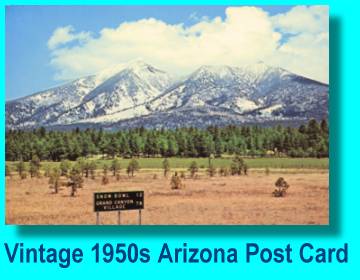
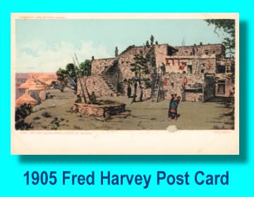
Vintage Arizona Post Cards from the Golden Years of Route 66 |
|
|
|
|
|
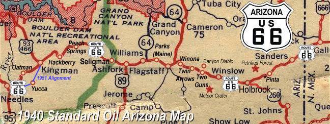
Detailed Vintage Arizona Route 66 Maps: [1928 Eastern Arizona] [1928 Western Arizona] (Route 66 goes through Oatman) |
[1953 Eastern Arizona] [1953 Western Arizona] (Route 66 bypasses Oatman) |
Click on an area or city of Route 66 on the map below to take a cyber tour of that section of the Mother Road |
|
|
NAVIGATION NOTE: Buckle up and hold on to your mouse! These pages are arranged like the map above, Oatman being West Route 66 and the Painted Desert East Route 66. I have set up this site as if you were traveling from EAST to WEST, much like the Joad family in The Grapes of Wrath. You can click on the Route 66 shields to "travel" the Mother Road in either direction though. Or you can select any shield below to take you to that specific state. |
|
To Oatman |
To the Painted Desert |

© Copyright 2003 GRandall Web Design Service